Understand FEMA Flood Zone Map Changes and Insurance Rates

coastal area with flood zone map overlay highlighting flood risk for homeowners 2b5847db 89d7 4bfc a985 b721047d4fb2

Flood Zone Map Changes: How FEMA Remapping Affects Your Flood Insurance Premiums

Changes to flood zone maps can greatly affect homeowners and businesses, especially in coastal regions. Understanding how the National Flood Insurance Program (NFIP) and FEMA’s remapping influence flood insurance requirements and premiums is essential for property owners to safeguard their investments. This article explores the role of flood insurance rate maps, classifications of floodplains, and the impact of remapping on home insurance costs and coverage. We also cover practical steps property owners can take when their floodplain status changes and how to appeal these changes if needed. By the end, readers will have a clear understanding of flood zone remapping and its effects on flood insurance and financial planning.

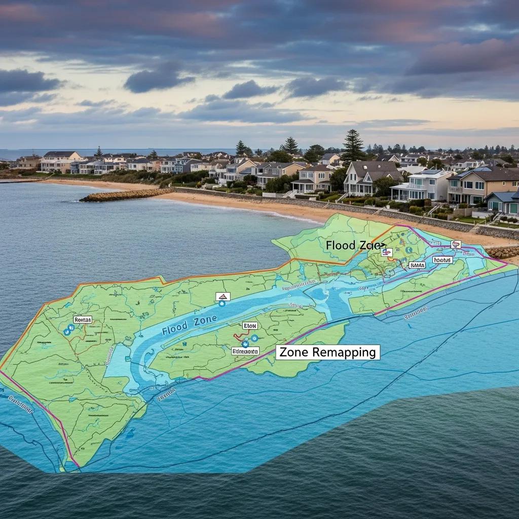
What Are FEMA Flood Insurance Rate Maps and How Do They Define Floodplains?

FEMA’s Flood Insurance Rate Maps (FIRMs) are key tools used to assess water-related hazards in various areas. These maps categorize regions into floodplain zones based on their average risk rating, which directly affects flood insurance requirements, coverage options, and premiums. FIRMs are updated periodically to reflect changes in water levels, environmental conditions, and development. Understanding these maps is vital for property owners, as they determine necessary home insurance coverage and potential flood insurance costs. For more details on flood insurance basics, visit our Flood Insurance Guide.

How Does FEMA Determine Floodplain Designations?

The National Flood Insurance Program uses a detailed approach to assign floodplain designations, analyzing historical water data, geography, and hydrological studies. Factors such as rainfall, river flow, coastal erosion, and base flood elevation are considered to assess average risk ratings accurately. This data-driven method ensures floodplain classifications reflect current and potential future water hazards, helping homeowners make informed decisions about their home insurance needs. Learn more about how to get accurate flood insurance quotes to understand this process better.

However, the mapping process can sometimes be influenced by factors beyond scientific assessment, as one study highlights.

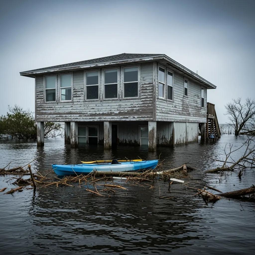
FEMA Flood Maps: Politics, Costs, and Community Vulnerability

Accurate flood maps are critical to communicating water hazards to vulnerable populations, mitigating and adapting to floods, and supporting the National Flood Insurance Program. Yet, little is known about how the mapping process works in practice. This article argues that politics can shape remapping in ways that leave communities vulnerable. Because mapping occurs within the NFIP context, local discussions often focus on the costs of revising flood hazard zones rather than the water hazards themselves.

Drawing lines: FEMA and the politics of mapping flood zones, S Pralle, 2019

Key Floodplain Classifications Affecting Coastal Properties

coastal landscape showing various flood zone classifications for property assessment be742a4c 7683 4147 af2f 2c519d9aacc4

Coastal properties are especially vulnerable to water hazards, particularly in floodplain areas. FEMA classifies these areas into several key categories:

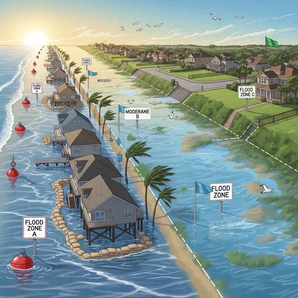
  • High-Risk Floodplain Zones: Areas with a 1% or greater annual chance of flooding, requiring mandatory flood insurance for mortgaged properties and significantly influencing home insurance terms. For more on high-risk zones, see Explanation of High-Risk Flood Zones.
  • Moderate-Risk Floodplain Zones: Areas with lower water hazard levels where flood insurance is recommended but not mandatory, helping manage average premiums and coverage expenses. Learn about Moderate-Risk Flood Zone Classifications for additional insights.
  • Low-Risk Floodplain Zones: Areas with minimal water hazard, where flood insurance is optional but offers financial protection and peace of mind. Explore options in Low-Risk Flood Zone Insurance Options.

Understanding these classifications helps property owners evaluate their floodplain status and choose appropriate home insurance coverage, especially when considering features like basements or other vulnerable property elements.

How Does FEMA Remapping Influence Flood Insurance Premiums?

FEMA remapping can cause notable changes in flood insurance premiums and coverage requirements. When an area is reclassified from a low-risk floodplain to a high-risk zone, homeowners may face higher premiums and stricter insurance requirements. Conversely, properties downgraded to lower-risk zones might see reduced premiums and coverage costs. Staying informed about these changes is essential for effective financial planning and managing home insurance expenses. For tailored flood insurance solutions aligned with FEMA remapping, Coastal Insurance Solutions for High-Value Homes specializes in protecting valuable assets from premium increases and coverage gaps, including private flood insurance options.

Factors Affecting Flood Insurance Rate Adjustments After Remapping

Several elements influence flood insurance rate changes following FEMA remapping:

Understanding these factors helps property owners navigate flood insurance complexities and make informed decisions about coverage and finance.

Interaction Between Floodplain Remapping and Water Hazard Assessments in Coastal Areas

Floodplain remapping and water hazard assessments work together to determine overall floodplain risk in coastal regions. These assessments consider historical water data, base flood elevation, and environmental changes to provide a comprehensive view of potential hazards. They inform FEMA’s remapping efforts, ensuring floodplain designations reflect current conditions. Property owners should regularly review these assessments to stay updated on their floodplain status, insurance requirements, and average premiums. For more on risk assessments, visit Flood Risk Assessment and Its Role in Insurance.

Steps for Property Owners When Floodplain Designations Change

Upon notification of a floodplain change, property owners should:

  • Assess Water Hazard: Review the new designation and understand its impact on insurance requirements and premiums.
  • Review Home Insurance Options: Consult insurance professionals to explore available flood insurance options, including private policies, that fit the new risk rating. See Private Flood Insurance Options and Benefits for alternatives.
  • Obtain Personalized Quotes: Coastal Insurance Solutions offers tailored quotes to help manage insurance needs and expenses effectively.

These proactive steps can reduce financial impacts and support better finance and emergency planning.

How to Appeal FEMA Floodplain Designation Changes

If property owners believe their floodplain designation is incorrect, they can appeal through a formal process. This involves gathering evidence such as historical water data, elevation certificates, or documentation of basement flood protection. Submitting a Letter of Map Amendment (LOMA) to FEMA is a key step, and local government support can aid the process. Understanding appeals empowers owners to challenge inaccurate designations and adjust home insurance accordingly. For detailed guidance, see FEMA Flood Zone Appeals Process and How to File a LOMA.

Mitigation Measures to Reduce Flood Insurance Premiums After Remapping

Implementing mitigation strategies can lower flood insurance premiums and coverage costs post-remapping. Effective measures include:

These actions protect properties and contribute to community safety and improved emergency preparedness.

Flood Insurance Options for High-Value Coastal Properties

luxury coastal property illustrating flood insurance options for high value homes 08090276 ef8d 4e94 be83 41764744264a

High-value coastal properties need specialized flood insurance to ensure adequate coverage. Options include:

  • Excess Flood Insurance: Provides coverage beyond standard NFIP limits, complementing home insurance. Learn about Excess Flood Insurance Coverage.
  • Worldwide Liability Coverage: Protects against liabilities globally, often part of comprehensive policies.
  • Customized Solutions: Tailored policies addressing specific risks for luxury homes, including floodplain and basement vulnerabilities. See Customized Flood Insurance Solutions for Luxury Homes.

Coastal Insurance Solutions offers expertise in crafting policies that meet high-value homeowners’ unique needs, helping manage flood insurance costs effectively. Explore high value home insurance options as well.

How High-Value Home Insurance Programs Address Floodplain Exposure

High-value home insurance programs cater to the unique water hazard exposure of luxury properties. These programs offer customizable flood insurance options, allowing homeowners to select coverage aligned with their specific needs and average risk ratings. Regular policy reviews ensure coverage remains adequate as property values and floodplain conditions change. This proactive approach helps manage flood risk and control insurance expenses. For more information, visit High Value Home Insurance Programs and Flood Coverage.

Benefits of Luxury Home Flood Coverage from Providers Like Chubb and PURE

Luxury home flood coverage from providers such as Chubb Luxury Home Insurance and PURE offers several advantages:

  • Comprehensive Protection: Extensive coverage for high-value assets ensures adequate protection through home insurance.
  • Higher Coverage Limits: Policies often feature higher limits to meet high-net-worth individuals' needs and floodplain risks.
  • Flexible Deductibles: Homeowners can choose deductibles that fit their financial strategies, providing flexibility in managing flood insurance costs.

These benefits make luxury home flood coverage essential for high-value property owners seeking to optimize insurance and financial planning.

How to Monitor and Stay Updated on FEMA Flood Insurance Rate Map Changes

Staying informed about FEMA flood insurance rate map changes is vital for property owners. Effective methods include:

  • Contacting Local Government: Local officials provide information on recent changes and upcoming remapping related to floodplains and average risk ratings.
  • Using FEMA's Map Service Center: This online resource offers access to the latest flood maps, base flood elevation data, and updates. Visit FEMA Map Service Center for Flood Maps.
  • Downloading the FEMA App: The app provides real-time alerts and updates on water hazards, map changes, and insurance implications.

Utilizing these resources helps property owners proactively manage their floodplain status, home insurance, and financial planning.

Resources for Timely FEMA Remapping Updates and Floodplain Data

Several resources offer timely updates on FEMA remapping and floodplain information:

  • FEMA Flood Map Service Center: A comprehensive platform for accessing flood maps, floodplain data, and related insurance information.
  • FEMA App: Delivers alerts and updates directly to mobile devices, supporting preparedness and insurance awareness.
  • Local Government Resources: Many municipalities provide floodplain management and remapping information through websites or offices.

These resources are invaluable for property owners seeking to stay informed about their floodplain status and insurance options, requirements, and average premiums.

How Continuous Monitoring Supports Flood Insurance Planning

Ongoing monitoring of water hazards and FEMA remapping is essential for effective flood insurance planning. Regular assessments allow property owners to adjust coverage as needed, ensuring protection against potential water events. Preventive insights from monitoring inform decisions about mitigation, insurance options, and finance management. Periodic policy reviews help homeowners align coverage with changes in property value, floodplain ratings, and exposure, supporting long-term financial stability and reducing average premiums and expenses.

Frequently Asked Questions

What should I do if I disagree with my new floodplain designation?

If you disagree with your new designation, you can appeal through a formal process. This involves gathering evidence such as historical water data or elevation certificates to support your claim. Submitting a Letter of Map Amendment (LOMA) to FEMA is a key step. Seeking local government support can strengthen your appeal. Understanding this process empowers property owners to challenge inaccurate designations effectively. For more details, see FEMA Flood Zone Appeals Process and How to File a LOMA.

How often does FEMA update flood insurance rate maps?

FEMA updates flood insurance rate maps periodically to reflect changes in water hazards due to environmental factors, development, and other influences. Update frequency varies based on local conditions and new data availability. Property owners should stay informed, as updates can impact insurance requirements and premiums. Regularly checking FEMA’s Map Service Center or local government resources helps track changes affecting floodplain status.

Can I lower my flood insurance premium without changing my floodplain designation?

Yes, several strategies can lower your flood insurance premiums without changing floodplain designation. Mitigation measures like installing flood barriers or elevating utilities reduce hazards and may lower premiums. Reviewing coverage amounts and deductibles can also help find affordable policies. Participating in community floodplain programs may lead to reduced rates. Consulting an insurance professional provides tailored strategies to manage costs effectively. Learn more at Flood Insurance Mitigation Strategies to Lower Premiums.

What role do local governments play in floodplain remapping?

Local governments play a vital role by providing data and insights that inform FEMA’s mapping process. They conduct assessments of water hazards and advocate for communities during remapping. Local officials assist property owners in understanding floodplain changes and navigating appeals if needed. Engaging with local resources enhances community resilience and ensures accurate hazard communication.

How can I find out if my property is in a high-risk floodplain?

To determine if your property lies in a high-risk floodplain, access FEMA’s Flood Map Service Center online. This resource provides detailed maps and floodplain information. You can also contact local government or planning departments for assistance in understanding your property’s status and recent changes affecting it.

What are the financial implications of being in a high-risk floodplain?

Being in a high-risk floodplain can lead to increased flood insurance premiums and mandatory insurance for mortgaged properties. This impacts overall financial planning. Properties in these zones may also face decreased market value and selling challenges. Understanding these implications helps owners manage investments and home insurance effectively.

Are there federal programs to assist with flood insurance costs?

Yes, federal programs like the National Flood Insurance Program offer subsidized rates for properties in participating communities. FEMA also provides grants for floodplain mitigation projects that reduce future hazards and insurance costs. Homeowners should explore these options and consult local officials to learn about available assistance.

About the Author

David W. Clausen is the CEO of Coastal Insurance Solutions. With over 20 years' experience and over 1 billion insured, David and Coastal Insurance Solutions are the recognized leaders in high net worth insurance. For the fifth consecutive year, David Clausen has been awarded Top Producer by Insurance Business America. David is a trusted high net worth insurance expert who’s published more than 200 articles. His articles & press releases have generated over 500K pageviews and has been featured on blogs such as Google News, Yahoo Finance, CNBC, Market Watch, Fox, The New York Times, etc. David founded Coastal Insurance Solutions in 2001 after earning a BBA from the State University of New York College at Oswego.

IBA's Top Retail Broker 2023
Digital badge for the 2023 Insurance Agents of the Year Award, featuring intricate design elements that symbolize excellence and achievement in the insurance industry.
IBA's Top Retail Broker 2023
Digital badge for the 2023 Insurance Agents of the Year Award, featuring intricate design elements that symbolize excellence and achievement in the insurance industry.

Helpful Flood Insurance Articles